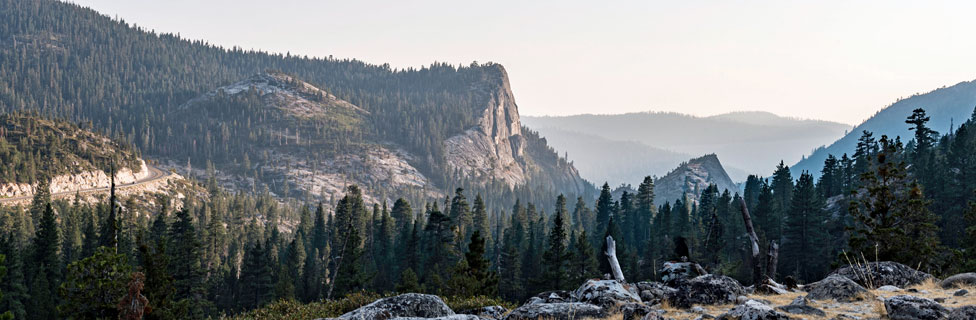
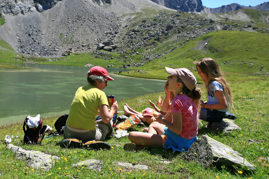
Picnic Spots around Echo Summit
Picnic sites - or Day Use Areas, as the Forest Service calls them - are found throughout the Crystal Basin and all along the Highway 50 corridor up to Echo Summit. Some are separate sites, others are in combination with campgrounds. Fees for using the areas vary and are not well advertised. Expect to pay $5 - $8 for a day use area, and then be pleasantly surprised when some locations are free. Interagency Annual, Senior, and Access passes (America the Beautiful) allow the holder to park for free at the Eagle Falls, Carson Pass, Carson Pass Overflow and Meiss Trailheads.
Visitors are free to stop at virtually any appealing location in the Eldorado National Forest and have a picnic. If you choose to have a campfire outside a developed Day Use Area, be sure to pick up a free campfire permit from a ranger office, perhaps in Camino.
Crystal Basin Day Use Areas
Angel Creek
Located at Gerle Creek Reservoir, 1 mile before the Gerle Creek Campground, elevation 5,300'. Four picnic sites with piped water and grills. Vault toilets. Access the Gerle Interpretive Trail and the Harvest Interpretive Trail.
Gerle Creek
Located at Gerle Creek Reservoir on Ice House Road, elevation 4,900'. Four picnic units with tables, piped water, grills, and vault toilets. Hiking trails, non-motorized boating, and wheelchair accessible fishing platform.
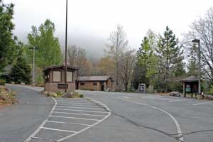
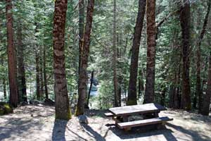
Cleveland Corral (shown right)
Located on Ice House Road, 2 miles north of Highway 50, elevation 3,980' at the Cleveland Corral Information Center. The picnic area has a great view of the countryside. Flush toilets nearby. Information and interpretive signs are located there, telling about the 1992 Cleveland fire.
Fashoda Beach
Located on Union Valley Reservoir at the Fashoda Campground, elevation 5,200'. Five picnic units with tables, piped water, and grills. One unit wheelchair accessible. Swimming beach nearby.
Ice House
Located near Ice House Campground, elevation 5,500'. Ten picnic units with tables, piped water, and grills. Fishing nearby.
Loon Lake
Located near Loon Lake Campground, elevation 5,200'. Five picnic units with tables and grills. Vault toilets are wheelchair accessible. Fishing, boating, and hiking nearby.
Wrights Lake
Located on Wrights Lake Road near the campground, elevation 6,941'. Ten picnic units with tables and grills. Vault toilets are wheelchair accessible. Popular spot for swimming nearby. Fishing, canoeing, and hiking close by.
Highway 50 Day Use Areas
Bridal Veil
Located 17 miles east of Placerville on the American River, elevation 3,200'. Thirty picnic sites with tables and grills. Not wheelchair accessible. Swimming and fishing nearby.
Fee
Bull Creek
Twenty-four miles east of Placerville on the American River, elevation 3,400'. Fishing and wading.
Indian Springs
Twenty-seven miles east of Placerville on the American River, elevation 3,900'. Fishing, kayaking and wading nearby.
Alder Creek
Located 28 miles east of Placerville on the American River, elevation 3,518'. Wading, kayaking, and fishing nearby.
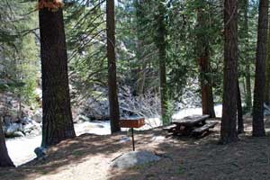
Eagle Rock (shown right)
Located 28 miles east of Placerville on the American River, elevation 4,400'. Kayaking, wading and fishing nearby.
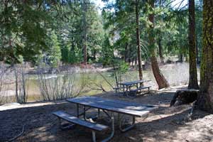
42-Mile (shown below, right)
Thirty-eight miles east of Placerville on the American River, elevation 5,700'. There is no sign for this area, so watch the mile markers and turn onto the little road at 42-mile. The picnic area, a single table, is immediately to the right before crossing the bridge. Swimming and fishing nearby.
Slippery Ford
Located 43 miles east of Placerville on the American River, elevation 6,200'. Wading and fishing nearby. Cross walking bridge to Old Lincoln Highway.
Sayles Flat
Forty-five miles east of Placerville on the American River, elevation 6,400'. Wading and fishing nearby.
China Flat
Set along the Silver Fork of the American River, 3 miles from Kyburz, elevation 4,800'. Drive about a hundred feet past the turn-in to the campground and then turn onto an unmarked road that leads down to a parking area by the river. Cross the foot bridge and turn left. Continue up the dirt road about 100 yards to a very nice picnic location. Vault toilets are found downstream in the campground. Swimming, fishing, biking, and hiking nearby. Find Heritage Markers around the adjacent campground telling about the sawmill that was located there in the early part of the 20th century.
Other Places for Picnics
Take a look at our Echo Summit Day Hikes page for some other good ideas for places to enjoy a picnic.
Echo Lakes - Ride the water taxi to the far end of the lakes and pick out your own scenic spot to enjoy a restful picnic.
Horsetail Falls - Hike a short distance up toward the falls or all the way to the top where you can picnic on the rocks with a spectacular view of the falls.
Sun Rock - From the Van Vleck trailhead in the Crystal Basin hike to Sun Rock for a relaxing picnic.