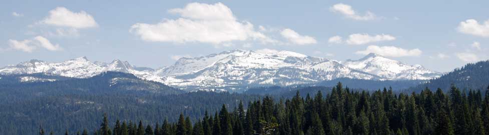

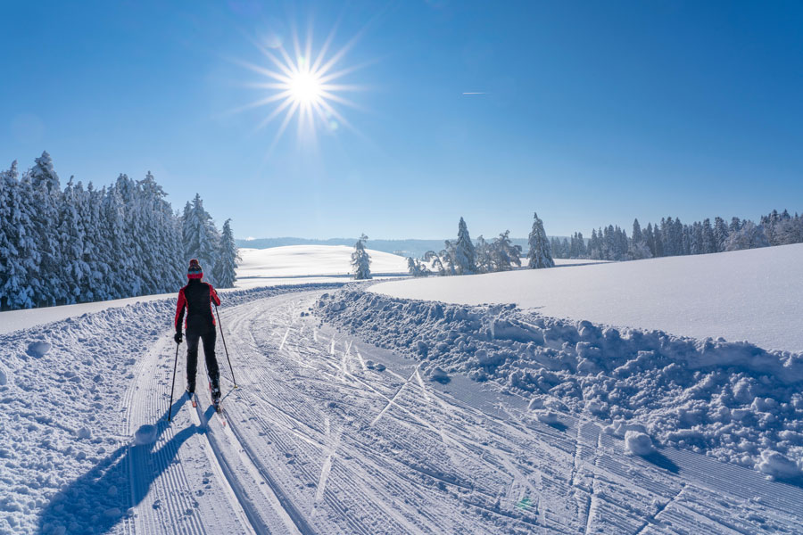
Cross Country Skiing around Loon Lake
Cross country skiing and snowshoeing are wonderful ways to explore the Crystal Basin in the winter. Loon Lake has been set up as a designated Nordic ski area with marked trails, a warming hut, restrooms, and spectacular scenery. With elevations ranging between 6400 feet and 6900 feet, cross country skiing is often good into May. Snowmobiling is not allowed at Loon Lake, helping to preserve the quiet beauty of the winter landscape.
Loon Lake is 30 miles north of Highway 50 on Ice House Road. To reach the Ice House Road turnoff, drive 20 miles east from Placerville. The road to Loon Lake is paved, but plowing is done irregularly and often not on weekends. 4-wheel drive vehicles are recommended during unsettled weather. At times when the snow is particularly heavy, the road is closed to all traffic.
Parking for Loon Lake skiers is found at the Loon Lake Chalet parking lot and two other nearby locations. The Chalet has a public warming room open in the winter. It is staffed with Forest Service employees or Ski Patrol personnel in winter weekends from 9:00 AM to 4:00 PM. Inside the warming rooms you will find picnic tables, hot and cold water, and a small kitchen area. Restrooms are accessed from the outside of the building and are always open. Pets are not allowed in the building.
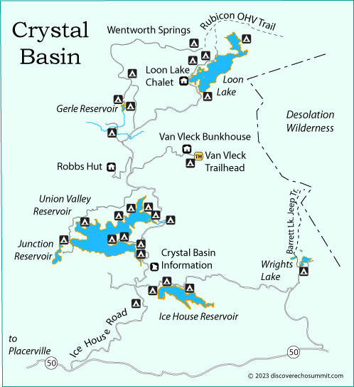
Cell phone service is available about 1 mile back down Ice House Road from the Chalet.
General Information: (530) 644-6048 Pacific Ranger Station: (530) 647-5415
Forest Service - Loon Lake Cross Country Skiing
Back Country Safety
- Check with the Forest Service before heading out to be sure conditions are safe on the route you will be using.
- Always carry emergency supplies and a cell phone.
- Let a responsible person know where you are going and when you will be returning.
- Travel with at least one other person.
- Carry an emergency locator beacon when skiing off trail.
The Sierra Avalanche Center provides information about avalanche conditions in the Sierra from Yuba Pass in the north to Ebbetts Pass in the south. Visit their website at Sierra Avalanche Center.
Loon Lake Nordic Trails
1. Chipmunk Bluff Trail
Distance: 1.5 miles one way
Difficulty and Elevation Gains: Easy, gently rolling terrain gaining about 150 feet
The trail starts on the west side of Loon Lake Chalet parking lot and leads southwest along the road to the ridge near Chipmunk Bluff.
2. Berts Lake Trail
Distance: 1.2 miles one way
Difficulty and Elevation Gains: Moderate, gently rising terrain, gaining about 400 feet
Start on the west side of Loon Lake Chalet parking lot, ski around the pond and climb the ridge to Berts Lake. Look for flag poles to guide you in open areas.
3. Polaris Trail
Distance: 2.5 miles one way
Difficulty and Elevation Gains: Easy, mild changes in elevation, rising and then descending about 100 feet
From the Chalet parking lot follow the road across the dam. Then continue north along the road as it circles part way around the lake to the second dam.
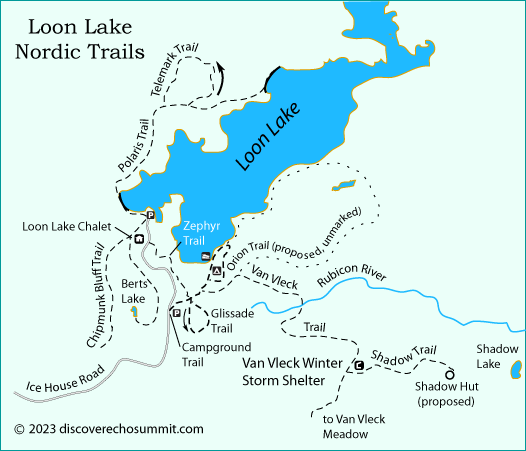
4. Telemark Trail
Distance: 4.3 miles round trip, including loop at end and return to start
Difficulty and Elevation Gains: Difficult, rolling terrain, with a steep descent into the bowl and return climb out of it.
Follow the Polaris Trail north about 1.5 miles. At the high point before the descent to the dam, turn off to the left (at the second sign) and ski counterclockwise uphill through the saddle and then down through a large open bowl before returning to the road.
5. Zephyr Trail
Distance: 0.7 miles one way
Difficulty and Elevation Gains: Moderate, rising 75 feet
Walk or ski south from the parking lot along Loon Lake Road to the trailhead on the east side of the road near the powerhouse. Ski southeast to the Campground Trail.
6. Campground Trail
Distance: 1.2 miles one way
Difficulty and Elevation Gains: Easy, gradual descent of about 75 feet
From the parking are on Loon Lake Road go east to the campground. The trail skirts the east edge of the boat ramp and follows looping roads through the campground. A good beginners trail.
7. Glissade Trail
Distance: 0.7 mile loop + approach of 0.2 miles on the Campground Trail
Difficulty and Elevation Gains: Moderate, climb and descend about 150 feet
Approach from either the Zephyr Trail or the Campground Trail and then go south in a counterclockwise direction in a small loop.
8. Orion Trail (unmarked)
Distance: 5-mile loop
Difficulty and Elevation Gains: Difficult, rise and descend about 300 feet
this proposed route is unmarked, so skiers should be experienced in cross country travel and carry appropriate route finding tools. The trail begins at the parking area at the trailhead for the Campground Trail. Follow the Campground Trail about one half mile and turn onto the Van Vleck Trail. After less than half a mile head east toward Brown Mountain. After a total of about 2.5 miles swing north toward Loon Lake, descending to its shore and following the shoreline west to the campground and back to the parking lot.
9. Van Vleck Trail
Distance: 5.6 miles one way
Difficulty and Elevation Gains: Moderate to Difficult, climbs and then descends 600 feet.
Turn east off the Campground Trail onto the Van Vleck Trail and the trail bridge at the Rubicon River. Continue southeast on the trail to the ridge and follow the blue diamonds to the Van Vleck Meadow area. When skiing this trail, the Forest Service recommends that you be aware of weather and snow conditions. They advise that you establish a turn-around time so you have enough daylight to return. A good turnaround place to make the route easier is mile 3.0 before the trail begins to descend.
10. Shadow Trail
Distance: 1 mile one way
Difficulty and Elevation Gains: Moderate, gains about 200 feet
Take the Van Vleck Trail 2.5 miles. From the Van Vleck Trail, turn east to the proposed Shadow Hut site. Look for distant views of Loon Lake.